We hiked at a good clip and passed the Indians we'd met the previous night before we entered the bowl below the Broken Hand Pass. The bowl to the north of the Pass is mainly scree that is difficult to climb and supports no vegetation. We were lucky that much of the bowl was covered in fields of soft snow. There was a well-defined boot pack and getting purchase with our boots was easy.
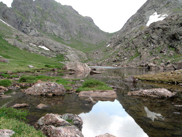
A beautiful alpine meadow awaited us on the south side of the Pass. The gentler slopes there allow mountain grass and flowers to grow. After descending steep switchbacks, we reached Cottonwood Lake. The sky was reflected in its still waters.


We hiked switchbacks several hundred feet from the base to the increasingly steep rock of the Peak's southern face. The last cairn we saw was just east of Couloir. We figured we were entering the couloir at the right spot. We climbed along the west and east sides of the Couloir and at one point hiked up a steep field of rock hard snow. We had ice axes but no crampons. Luke asked me whether I would be able to self-arrest. I doubted I could. His question planted a seed of fear in me.
We got off the snow field and continued climbing to a point thirty or fifty feet below where the Couloir seemed to turn into cliffs that couldn't be climbed without protection. We exited the Couloir to the east and began scrambling up the rock face. We had no idea whether we were on route.
The face became steep enough that I doubted we could continue. Luke was more sanguine. While I sat tight, he climbed above me and moved beyond my range of vision. Five minutes later, he shouted down that he'd found a route that would take us back to the Couloir above the cliffs. Around the same time, I caught sight of the Indian climbers far below me. They noticed me and began shouting from several hundred feet below. I couldn't make out what they were saying and followed Luke's route without answering.
I climbed another 100 feet up. Then we moved west to re-enter the Couloir. The Couloir was a good 10 or 15 feet below the rock face. I got back to it by lowering myself down a natural stairwell between two large rocks. We eventually reached a long snow field that had been softened by the sun. Our boots got good purchase. After the snow field, we climbed a series of knobs and steps along the Couloir's east side. Then we reached the saddle between the two summits and climbed the short pitch to the west summit.
Two other climbers had already reached the summit. They told us they had made two previous unsuccesful attempts to summit Crestone Peak. They had spent a couple of hours that day doing route finding on the rock face east of the Couloir. Crestone Peak was certainly the most challenging mountain I'd done from a route-finding or exposure to heights perspective. The other climbers took our picture and then I took theirs. I cracked sarcastically that it would be the cover of the next issue of Outside.
On the descent, we encountered one of the Indians in the Couloir at an elevation around 13,500 feet. His partner had given up the hike because of altitude sickness. He had left his ice ax with the sick guy and continued up the Couloir alone. He asked whether he could safely continue. We said it was his call but it would be safer to return since he was solo and he had no ice ax. Also, it was almost noon, putting him in danger of getting caught by an afternoon rain that might make the rock unclimbable.
The Red Couloir during the descent. The lead Indian climber is in the upper left.
When we got back to the Broken Hand Pass, the leader of the climbers we met on the summit caught up with us. The Indian climber who had altitude sickness had postholed on a snowfield in the Couloir and got stuck. The leader Indian climber had dug him out with their shared ice ax. Both of them had made it out of the Couloir and down to the base of the Peak, which came as a relief to me.
Luke and I got back to the camp by 3:00 p.m. As we were driving down the Forest Service road back to Westcliffe, a terrific storm broke over the South Colony Lakes. Massive clouds moved in and thick tendrils of rain streamed down. Our timing was perfect.
July 12, 2008


No comments:
Post a Comment